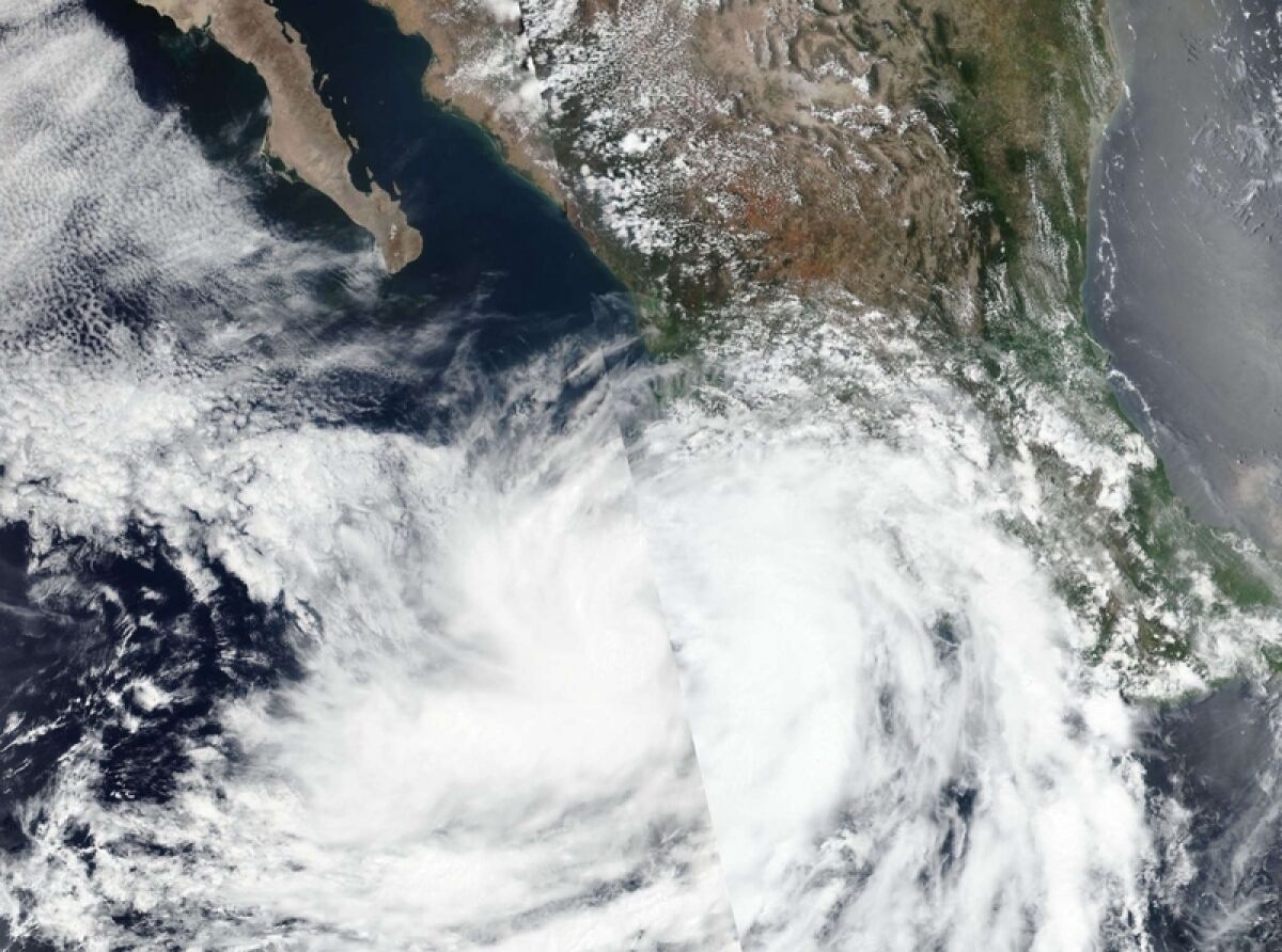
Hurricane Enrique is threatening our coast putting the Jalisco southern coast on hurricane watch.
As of 1:00pm Enrique is about 110 miles, or 175 kms south of Cabo Corrientes, and 390 miles, or 630 kms SE of Cabo San Lucas.
It has reached sustained winds of 90 MPH, or 150 KM/H and is moving north at about 7 MPH, 11 KM per hour.
At 1:00 PM CDT, the center of Hurricane Enrique was located near latitude 18.8 North, longitude 105.7 West. Enrique has moved slightly east and to the north over the past few hours near 7 mph (11 km/h). A turn toward the north-northwest and then northwest is expected to begin by tonight. That general motion should continue thereafter for a few days.
On the forecast track, the core of the hurricane, along with the strongest winds, should remain just offshore of southwestern Mexico through tonight. Maximum sustained winds are near 90 mph (150 km/h) with higher gusts. Some slight strengthening is possible through tonight. Enrique is then expected to begin weakening on Monday and continue to weaken through early this week. Hurricane-force winds extend outward up to 25 miles (35 km) from the center and tropical-storm-force winds extend outward up to 125 miles (205 km). The estimated minimum central pressure is 977 mb (28.85 inches).
SUMMARY OF WATCHES AND WARNINGS IN EFFECT:
A Hurricane Watch is in effect for... Manzanillo to Cabo Corrientes Mexico
A Tropical Storm Warning is in effect for... Punta San Telmo to Punta Mita Mexico
A Tropical Storm Watch is in effect for... Punta Mita to San Blas Mexico
A Hurricane Watch means that hurricane conditions are possible within the watch area, in this case within the next 24 to 36 hours.
A Tropical Storm Warning means that tropical storm conditions are expected somewhere within the warning area.
A Tropical Storm Watch means that tropical storm conditions are possible within the watch area, generally within 48 hours.
WIND: Tropical storm conditions are occurring in portions of the warning area and will continue to spread northwestward within the warning area through tonight. Hurricane conditions are possible by tonight in the Hurricane Watch area. Tropical storm conditions are possible in the Tropical Storm Watch area today and Monday.
RAINFALL: Through Tuesday, the eastern outer bands of Enrique are expected to produce total rainfall amounts of 6 to 12 inches with isolated maximum amounts of 18 inches over Colima and coastal sections of Jalisco, Michoacan, and northern Guerrero in southwest Mexico. These amounts would likely produce life-threatening flash flooding and mudslides over portions of southwestern Mexico.
SURF: Swells generated by Enrique will affect the southwestern coast of Mexico during the next few days. These swells are likely to cause life-threatening surf and rip current conditions
Key messages for Hurricane Enrique can be found in the Tropical Cyclone Discussion under AWIPS header MIATCDEP5, WMO header WTPZ45 KNHC.
Updates can also be found on the NOAA website

